
David Bidwell

Email: david-bidwell@news.ok.ubc.ca


The post The hottest course on campus puts peppers on the table, students in the lead appeared first on UBC's Okanagan News.

The earth as seen from space, with a focus on the continent of Asia.

The rise of Earth’s continents may have tuned ancient oceans to just the right boron concentration for life to emerge, according to a new research study.

Earth’s earliest continents may have set the chemical stage for life by regulating boron levels in ancient oceans, a new study in Terra Nova suggests.  

Scientists have long proposed that boron helps stabilize the fragile sugars needed to build RNA—the molecule thought to have preceded DNA in early life—making it an essential ingredient in life’s origins.  

But boron operates within a narrow window: too much, and it becomes toxic to biological systems; too little, and it may never have contributed to life getting started. 

“What we’re talking about is a geological control system for Earth’s surface chemistry,” said Dr. Brendan Dyck, Associate Professor of Earth and Environmental Sciences in UBC Okanagan’s Irving K. Barber Faculty of Science. “The growth of continents didn’t just reshape the surface of the Earth—it may have helped set the chemical conditions that made life possible in the first place.” 

Dr. Dyck and collaborator Dr. Jon Wade from the University of Oxford found that before significant landmasses emerged more than 3.7 billion years ago, boron concentrations in Earth’s early oceans were likely dangerously high. The rise of granite-rich continental crust, they argue, changed that. 

The key was a boron-containing mineral called tourmaline, popularly known as a semi-precious stone that’s also abundant in continental rock.  

Tourmaline forms readily within granite-rich crust, locking boron away over geological time. As Earth’s crust grew and weathered, boron was slowly and steadily released into surface waters, eventually stabilizing at concentrations close to those found in modern seawater.  

This was within the range that, according to current scientific thinking, life can use. 

That stabilization, the researchers suggest, may have been especially important on the early Earth, where without it, the fragile chemical building blocks of life would have broken down before they could combine into more complex structures. 

The findings also raise questions about the search for life on other planets. Rocky planets lacking granite-rich continental crust, such as Mars, are unlikely to have surface waters with boron in a form life can use, suggesting that the geological evolution of a planet may be as important to habitability as its distance from the sun. 

“This work reveals that the slow geological evolution of a planet’s interior can meaningfully shape the surface environment in ways that may be critical for life.” 

The post How the rise of continents may have set the stage for life on Earth appeared first on UBC's Okanagan News.

An aerial photo shows the difference between untouched landscape and forest affected by wildfire. Through the middle, a river separates the brilliant forest from char.

UBC Okanagan researchers analyzed more than four decades of satellite data to identify where climate unpredictability poses the greatest threat to Canadian biodiversity.

Climate change is making Canada’s seasons more erratic, its weather more extreme and its ecosystems less predictable—and UBC Okanagan scientists have now produced the first national map of exactly where that unpredictability is hitting hardest.

Their findings, published in the Nature Portfolio journal Communications Earth & Environment, reveal a troubling mismatch: the regions best shielded from climate chaos are among the least protected by Canada’s national network of parks and conservation areas.

“We’ve been calling this ‘predicting the unpredictable,’” says Dr. Michael J. Noonan, assistant professor of biology and head of UBCO’s Quantitative Ecology Lab.

“Some parts of Canada tend to be relatively stable year after year, while others swing wildly. What we’ve shown is that this pattern of instability has real, measurable consequences for biodiversity. And our protected areas weren’t designed with any of this in mind.”

The research team, including master’s student Rekha Marcus, doctoral student Stefano Mezzini and undergraduate student Dwija Desai, analyzed more than four decades of daily satellite vegetation data stretching from 1981 to 2025.

Using this record (the longest and most detailed of its kind applied to Canada as a whole) they built precise, location-by-location estimates of how unpredictable environmental conditions have become across the country’s roughly 9.8 million square kilometres of land.

The technical term for this unpredictability is “stochasticity,” or the random, hard-to-forecast variation in conditions that species must navigate.

The researchers found it has been rising steadily for four decades and, crucially, that it is not distributed evenly.

More unpredictability means fewer species

The study found a strong, negative relationship between environmental instability and species richness: regions where conditions fluctuate more unpredictably support a significantly lower diversity of plants and animals. The effect holds even after accounting for how productive an ecosystem is.

Environmental stochasticity across Canada has increased steadily since 1981.

The team found pronounced geographic patterns: some ecozones—including parts of the Pacific Maritime, Montane Cordillera (southern BC and southwestern Alberta, including the Okanagan) and Atlantic Maritime—experience consistently higher instability, while others remain comparatively stable.

Unstable environments also suffer more extreme temperature events. Areas with high unpredictability were also more likely to experience months with extreme temperatures relative to historical baselines, compounding the stress on wildlife.

Canada’s protected areas are misaligned with where they’re needed most.

The researchers found no meaningful relationship between environmental stability and whether a region is currently protected.

Many of Canada’s most stable, biologically productive landscapes remain outside the protected areas network.

“High environmental variability can increase extinction risk and make protected areas less effective at safeguarding biodiversity, and climate change is expected to increase that variability,” said Marcus, the lead researcher.

“By analyzing how environmental conditions vary across Canada, we identified a significant number of areas that should be priorities for biodiversity conservation.”

The team identified more than 2.7 million square kilometres of unprotected land that ranks in the most stable and productive 30 per cent of the country. These areas could help meaningfully strengthen the resilience of Canada’s conservation network.

Implications for Canada’s 30 by 30 commitment

Canada has committed to protecting 30 per cent of its land and ocean habitat by 2030. With only 13.8 per cent currently under formal protection, the country faces an urgent task of identifying more than 1.7 million additional square kilometres for designation in the next four years.

The UBC Okanagan team argues that conventional approaches to identifying protected areas, which typically focus on average environmental conditions, are not enough.

Ignoring how conditions vary around that average, they say, risks building a conservation network that looks good on paper but cannot buffer wildlife against the increasingly erratic climate Canadians are already experiencing.

The study also identified another gap: areas that experience the most extreme temperature events, primarily in Canada’s northern regions, are underrepresented.

“As climate change makes the world around us increasingly less predictable, our protected areas may not have the capacity to buffer against this,” Dr. Noonan says. “This research gives decision-makers a new set of tools to identify where protection will be the most effective. Not just for today, but for decades to come.”

The post Canada’s protected areas were built for the past; research shows they may not support the future appeared first on UBC's Okanagan News.

A cluster of five eggs rest in hay, all reflecting natural light in subtle ways to make them seem different colors.

UBC Okanagan researchers and Canadian egg farmers have created a practical tool to help producers balance environmental and economic trade-offs.

Researchers at UBC Okanagan and Canadian egg farmers have built a practical decision-making tool to help producers balance environmental, economic and management trade-offs on their farms.

The project developed software that brings together key sustainability indicators in one place to help farmers establish benchmarks for their farms, compare options and understand the consequences of different green technology adoption and management choices.

“Too often, sustainability tools work in theory but fail in practice, or lack buy-in from their intended audience,” says Dr. Vivek Arulnathan, an alumnus from UBCO’s Interdisciplinary Graduate Studies program. “By involving farmers throughout the design process, we built something that reflects how decisions are actually made on farms.”

Farmers were involved throughout the process, shaping what information mattered, how it was presented and how it could be used to inform operations on the ground.

The study, published in Sustainability, was led by Dr. Arulnathan, a researcher with UBCO’s Food Systems Priority Research for Integrated Sustainability Management Lab, alongside Dr. Eric Li from the Faculty of Management and Dr. Nathan Pelletier, an associate professor of sustainable food systems at UBC Okanagan.

The research team worked directly with egg farmers to shape how sustainability information is presented, interpreted and used in daily decision-making. The approach recognizes that these measures only matter if they align with the realities of farm operations, regulatory pressures and economic constraints.

Farmers involved in the project helped identify the most useful sustainability measures, decide how to show results and make the trade-offs more transparent.

The study also highlights how the approach works as a scalable model for other agricultural sectors facing similar challenges, from livestock production to crop systems. By involving stakeholders early, the sustainability tools are more likely to be trusted, adopted and maintained over time.

According to Dr. Pelletier, the work links sustainability science and agricultural practice.

“Producers are under increasing pressure to measure sustainability performance and demonstrate improvement over time, but the tools available to them rarely reflect their operational context. This research shows how co-design can bridge that gap.”

The post Researchers, egg farmers hatch sustainable agriculture plans appeared first on UBC's Okanagan News.
Aerial view of a forested landscape with irregular patches of trees and cleared areas under daylight.

A patchwork forest landscape highlights how forest loss and fragmentation can change the way watersheds store and release water, according to new UBC Okanagan research.

Forest loss does more than reduce tree cover. A new global study involving UBC Okanagan researchers shows it can fundamentally change how watersheds hold and release water.

The research, published in Proceedings of the National Academy of Sciences, analyzed data from 657 watersheds across six continents.

It found that both forest loss and changes in forest landscape pattern cause watersheds to release a higher proportion of “young water”—rain and snowmelt that moves through a watershed within roughly two to three months of falling.

“Young water is a signal that water is moving quickly through a system,” says Ming Qiu, lead author of the study and a doctoral student in UBC Okanagan’s Earth and Environmental Sciences program.

“When the young-water fraction is high, it means less water is being stored in soils and groundwater for use during drier periods.”

The study was co-authored by Qiu and Dr. Adam Wei, professor in UBCO’s Irving K. Barber Faculty of Science. Together, they examined how forest cover and landscape configuration interact to influence watershed hydrology at a global scale.

The findings have direct implications for forest and watershed management, particularly in regions where timber harvesting is economically important. Rather than framing decisions as a binary choice between conservation and development, the research suggests there is room for more nuanced planning.

“Forest loss clearly reduces a watershed’s ability to retain water,” Dr. Wei says. “But our results also show that how forests are arranged on the landscape can either worsen or help mitigate that impact. Landscape planning can be part of the solution.”

Previous research has largely focused on forest quantity, or how much forest is removed. This study adds a crucial new dimension: spatial arrangement. In watersheds with relatively low forest cover, typically below 40 to 50 per cent, how the remaining forest patches are arranged strongly influences how water moves.

In these sparsely forested landscapes, an increase in forest edges—where forest meets cleared or open land—was linked to lower young-water fractions. Forest edges experience more solar radiation, lower humidity and altered microclimates, which can increase evapotranspiration and reduce runoff.

By contrast, in watersheds with higher forest cover, forest pattern had little effect. When forests are dense and contiguous, edges are closer together and microclimate changes are muted, limiting their influence on water partitioning.

“This was one of the most surprising findings,” Qiu says. “Forest pattern matters most when forest cover is already low. Above a certain threshold, its influence largely disappears.”

As extreme weather increases pressure on water resources, understanding how land-use decisions affect long-term water availability is becoming increasingly urgent.

“Watersheds are nature’s water-storage systems,” Qiu says. “If we want water that lasts through dry seasons—for communities, ecosystems and industry—we need to think beyond how much forest we lose and start thinking carefully about how the remaining forest is laid out.”

The post Forest loss can make watersheds “leakier,” global study suggests appeared first on UBC's Okanagan News.

Water rushes through a creek, with rugged mountain terrain and burned trees on either side.

New UBC Okanagan research shows wildfire can change how much water remains in streams during the driest months of the year.

Wildfires don’t just burn forests. They can also change how much water is left in creeks and rivers in summer, when water is scarce and demand is high, according to new research led by UBC Okanagan. 

Published in Forest Ecosystems, the study looks at stream flows between July and September—after spring snowmelt and before fall rains.

These flows matter because they determine how much water is available for drinking, irrigation, fish habitat and emergency response during heat waves and drought.

“This is the kind of study that helps move us from ‘wildfire changes flow’ to ‘here’s why, when and through which pathways,’” says Shixuan Lyu, lead author and a doctoral student with UBC Okanagan’s Department of Earth and Environmental Sciences.

“In water management, mechanisms matter because they affect what you can plan for and how long changes might last.”

They used a combination of long-term stream measurements and chemical “fingerprints” that revealed where the water originated. Researchers found that burned watersheds in the Okanagan Valley had more water flowing later into the summer than unburned watersheds, but with considerable variations.

At first glance, that might sound like a benefit. But the researchers say the apparent boost comes with important caveats.

“Low flows are the pinch point for communities, agriculture and fish habitat,” said Dr. Adam Wei, senior author and a hydrologist with UBC Okanagan. “Understanding how wildfire reshapes the seasonal balance between snowmelt, groundwater and water loss to the atmosphere is key to building realistic watershed strategies in a warming climate.

“It’s also important to understand that every watershed is unique, with different water responses to wildfires, so management strategies must be tailored to local watersheds.”

After wildfire, fewer trees mean less water is pulled back into the atmosphere, and more snowmelt reaches streams and underground storage earlier in the year. That can temporarily increase summer low flows; however, as forests recover, water losses are expected to rise again. In some cases, they may exceed pre-fire levels.

The findings suggest wildfire can briefly reshape water availability during the dry summer, but they also underscore the need for long-term monitoring and careful planning as extreme weather, wildfire and water demand increasingly intersect.

“This isn’t a new source of water,” said Lyu. “It’s a shift in timing and pathways, and those shifts don’t last forever.”  

The post Why some creeks run stronger after wildfire—and why it doesn’t last appeared first on UBC's Okanagan News.
A young woman points into the distance as she speaks to an older man with Indigenous regalia at the edge of a forested cleraring.

Dr. Magali Nehemy speaks to Cacique Domingos Mundurukú, local elder from Aldeia Bragança, Pará, in the Amazon during a research trip to study how the forest recycles rainfall.

An international research team has found that during the Amazon’s dry season, forests rely heavily on recent rainfall stored in shallow soil to keep the region’s climate in balance. 

Published in Proceedings of the National Academy of Sciences (PNAS), the UBC Okanagan-led study found that most of the water used by trees in eastern Amazon forests during the dry season comes from the top 50 centimetres of soil—water that fell only weeks or months earlier. 

“The Amazon forest produces its own rain by quickly returning water to the atmosphere via transpiration and producing its own rainfall when it needs it the most, during the dry season,” says Dr. Magali Nehemy, Assistant Professor of Earth and Environmental Sciences at UBCO.  

“Transpiration—water that is returned to the atmosphere by plants—is the largest flux on land. Changing forests changes this process, which in turn impacts rainfall, water availability and the ecosystems that depend on it.” 

In the Amazon dry season, up to 70 per cent of rainfall can come from this recycled moisture.  

Working in Brazil’s Tapajós National Forest during the peak of the dry season, Dr. Nehemy’s team collected data across two sites: a hilltop forest with a deep water table and a valley forest near a stream where groundwater is shallower.  

“The results were surprising,” says Dr. Nehemy. “Most of the water used for transpiration in the dry season did not come from deep reserves but from shallow soil. In a year without extreme drought or floods, nearly 70 per cent of transpiration on the hill and nearly half in the valley came from the top 50 centimetres of soil.”  

The study also shows that a tree’s embolism resistance, or how well it moves water through its tissues under drought conditions, explains why some species can keep using this recently fallen rain while others must rely on deeper stores.  

“It means the diversity of species and their drought resistance are directly tied to how the forest stabilizes its own climate,” says Dr. Nehemy. 

For her, the work is not only about physics and roots, but also about people. The field sites sit within the traditional territory of the Munduruku people. Many of the most protected forests left in the Amazon are in Indigenous territories.  

The findings have direct implications for climate models and policy.  

By linking tree traits, shallow soil water use and dry-season rainfall, the study offers a more mechanistic way to represent Amazon forests in land-surface and climate models, including those used to assess tipping points and water security under continued deforestation and warming.  

“In the long term, I would like us to be able to predict how changing vegetation cover shapes water availability via rainfall and climate vulnerability across different areas,” says Dr. Nehemy.  

“The Amazon really is a rain-making engine. If we weaken the forest’s ability to recycle water, we risk weakening the entire hydrological cycle that supports people, ecosystems and agriculture far beyond the forest itself.” 

The post Why the Amazon’s ability to make its own rain matters more than ever appeared first on UBC's Okanagan News.
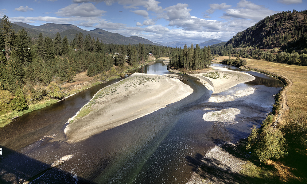
A photo of people on a beach viewing the McDougall Creek wildfire from across Okanagan Lake.

People sit on an Okanagan Lake beach viewing a distant wildfire.

How wildfires spread is more variable and unpredictable than Canada’s standard models assume, new research from UBC Okanagan data scientists shows.

Ladan Tazik, lead author of a new study in Fire and UBC Okanagan doctoral student, used advanced computer vision tools to capture fire behaviour with a level of detail that wasn’t possible even a few years ago.

Her work sheds light on the random elements of fire movement—information that could reshape how fire behaviour is modelled and forecasted in an era of worsening wildfire seasons.

“Image processing techniques let us quantify fire behaviour in real time, including the parts that don’t follow consistent patterns,” says Tazik. “By capturing the randomness in how fires spread, we can build models that better reflect reality and help improve decision-making during active fire events.”

Tazik led the design, analysis and modelling that form the backbone of the study.

She used the “Segment Anything Model”, a state-of-the-art AI tool, to extract fire perimeters from experimental burn videos frame by frame to study fire spread dynamics.

This allowed her to study directional fire spread on sloped terrain without assuming the fire behaves predictably or spreads in a simple line.

Her analysis confirmed something firefighters may know instinctively: fires race uphill. But when she compared her measurements with the values used in Canada’s official Fire Behaviour Prediction System, the numbers didn’t always line up.

Real fires often moved faster, and the influence of slope wasn’t consistent from place to place.

She tested the method on ponderosa pine and Douglas fir fuels often used in fire research.

This highlights that small differences in fuel, wind and terrain can add to the unpredictability of fire and introduce important variations in how it spreads.

Even under nearly identical conditions, the flames didn’t behave the same way twice.

In practical terms, that means most fire spread is shaped by randomness—far more than today’s deterministic models capture.

“These results show that we need to pair every spread estimate with a measure of uncertainty,” Tazik explains. “Simply multiplying by a slope factor isn’t enough. Fire is dynamic, and our models should acknowledge that.”

Research supervisor Dr. W. John Braun says the project demonstrates how emerging computer vision tools can transform wildfire science.

“Tazik proposed innovative ways to tackle this difficult modelling problem,” he says. “Her work shows how high-resolution perimeter data and advanced modelling can help us understand the real variability in fire behaviour. That’s essential if we want to move toward more probabilistic, data-driven prediction systems.”

The study also included contributions from Dr. John R.J. Thompson, Assistant Professor of Data Science, Mathematics and Statistics, as well as other partners who provided the experimental and field video datasets.

While the fuel experiments supported the research, Tazik alone led the segmentation and modelling components.

Tazik says the next step is to expand the approach to more fuel types and fire conditions and use airborne or satellite imagery to study fire spread dynamics.

With more Earth observation and remote sensing tools available, she sees an opportunity to build models that better capture wildfire dynamics while embracing the inherent uncertainty of fire, rather than smoothing it away.

“Fires don’t behave perfectly,” she says. “Our tools shouldn’t pretend they do.”

The post AI-powered vision gives meaning to wildfire chaos appeared first on UBC's Okanagan News.

UBCO-led Let’s Talk Science educators spend two weeks teaching nearly 1,000 youth around Prince Rupert, BC—a 2,000-kilometre round trip

The post Bringing STEM education to the North appeared first on UBC’s Okanagan News.

Two researchers in a laboratory setting: doctoral student Tuan-Anh Nguyen on the left and Dr. Thu-Thuy Dang examining plant samples. They are conducting research on how tropical trees produce mitraphylline, a rare compound with potential anti-cancer properties at UBC Okanagan.

UBC Okanagan doctoral student Tuan-Anh Nguyen, left, and Dr. Thu-Thuy Dang examine plant samples in their lab. Their research has uncovered how tropical trees produce mitraphylline, a rare compound with potential anti-tumour properties.

Researchers at UBC Okanagan have uncovered how plants produce mitraphylline, a rare natural compound that may help fight cancer. 

Mitraphylline belongs to a small group of plant molecules called spirooxindole alkaloids.  

These compounds have unusual “twisted” ring structures and are known for their strong effects, like fighting tumours and inflammation.  

Despite their promise, the molecular process that plants use to make spirooxindoles remained a mystery. 

That changed in 2023, when Dr. Thu-Thuy Dang’s research group in the Irving K. Barber Faculty of Science found the first plant enzyme that can twist a molecule into the spiro shape.  

“This is similar to finding the missing links in an assembly line,” says Dr. Dang, UBC Okanagan Principal’s Research Chair in Natural Products Biotechnology. “It answers a long-standing question about how nature builds these complex molecules and gives us a new way to replicate that process.” 

Building on that breakthrough, doctoral student Tuan-Anh Nguyen led the effort to identify a pair of enzymes—one that sets up the molecules’ 3D configuration and another that twists it into mitraphylline. 

Natural compounds are often found in very small amounts in plants, making them difficult or costly to reproduce in the lab. Mitraphylline is one such example: it occurs only in trace amounts in tropical trees like Mitragyna (kratom) and Uncaria (cat’s claw), members of the coffee family.  

By identifying enzymes that build and shape mitraphylline, researchers now have a roadmap for producing it and related compounds in sustainable ways. 

“With this discovery, we have a green chemistry approach to accessing compounds with enormous pharmaceutical value,” says Nguyen. “This is a result of UBC Okanagan’s research environment, where students and faculty work closely to solve problems with global reach.

“Being part of the team that uncovered the enzymes behind spirooxindole compounds has been amazing,” he adds. “UBC Okanagan’s mentorship and support made this possible, and I’m excited to keep growing as a researcher here in Canada.” 

The project is the result of collaboration between Dr. Dang’s lab at UBC Okanagan and Dr. Satya Nadakuduti’s team at the University of Florida.  

The work was supported by Canada’s Natural Sciences and Engineering Research Council’s Alliance International Collaboration program, the Canada Foundation for Innovation, and the Michael Smith Health Research BC Scholar Program. Support also came from the United States Department of Agriculture’s National Institute of Food and Agriculture. 

“We are proud of this discovery coming from UBC Okanagan. Plants are fantastic natural chemists,” Dr. Dang says. “Our next steps will focus on adapting their molecular tools to create a wider range of therapeutic compounds.” 

The post Researchers reveal how plants make anti-tumour drugs appeared first on UBC's Okanagan News.